

Dooars
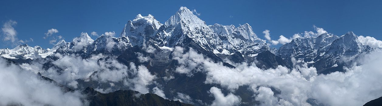
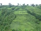
The Dooars or Duars are the floodplains and foothills of the eastern Himalayas in North-East India around Bhutan. And the region forms the gateway to Bhutan from India. There are 18 passages or gateways through which the Bhutanese people can communicate with the people living in the plains. This region is divided by the Sankosh River into the Eastern and the Western Dooars, consisting of an area of 8,800 km² (3,400 sq mi). The Western Dooars is known as the Bengal Dooars and the Eastern Dooars as the Assam Dooars. Dooars is synonymous with the term Terai used in Nepal and northern India and form the only nitrate rich soil in India.
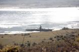
Dooars literally means gateway / door to Bhutan and North East India situated in the foothills of Himalaya crossed with rivers. The major river is the Teesta besides many others like the Jaldhaka, Torsha, Murty, Sankosh, Karatoya, Raidak, Kaljani and Dyna.
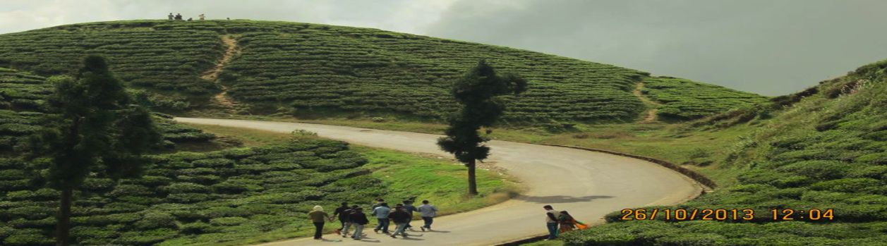
The Dooars is spread from Darjeeling foothills to the foothills of Arunachal Pradesh and is known for its rich biodiversity and forests. There are fabulous wildlife sanctuaries with scenic beauty, log huts and Toto Para, the habitat of the rare and smallest surviving tribe known as the Toto. Summer is mild and winters are cold with foggy mornings and nights. Dooars is home to 5 major national parks and sanctuary each has their own unique settings. Chilapata forest is near Alipurduar. Jaldhaka is close to Bindu and is a perfect destination for leisure holidays. Neora Valley, Parren Busty, DhupJhora, Kalimati, Kalikapur are some of the offbeat sites and are worth visiting. The amenities are basics, luxury hotels or resorts in Dooars are limited.
Climate
The average rainfall of the area is about 3,500 mm. Monsoon generally starts from the middle of May and continues till the end of September. Winters are cold with foggy mornings and nights. Summer is mild and constitutes a very short period of the year.
Places of interest in Dooars
- Jaldapara Wildlife Sanctuary:
Jaldapara Wildlife Sanctuary is a national park situated at the foothills of the eastern Himalayas in Alipurduar District of Northern West Bengal on the bank of river Torsa in West Bengal. The vast grassland with patches of riverine forests, was declared as the sanctuary in for the protection of the great variety of flora and fauna.
- Gorumara National Park:
Gorumara National Park is situated in the northern West Bengal, India. It lies in the Himalayan foothills and has a great natural beauty. The park is located on the bank of rivers Murti and Raidak and has vegetations of riverine grasslands interspersed with savannah woodlands.
- Chapramari forests:
Chapramari forests is essentially a continuation of the Gorumara National Park. The two forests are divided by the Murti River. The North East side of the river is Chapramari Wild Life Sanctuary whereas the South West side is where Gorumara is located.
- Buxa tiger reserve/ Buxa Duar:
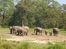
Once famous for dolomite mining, Buxa was declared a tiger reserve in 1983 and got the status of National park in 1992. Located in the Assam-Bhutan border, Buxa has an area of 745 sq km, the largest forest in North Bengal and has the second highest tiger population in West Bengal after Sunderbans.
The park holds maximum number of elephant, Indian bison, leopard, many species of deer and many smaller mammals, innumerable species of birds and reptiles. Buxa is rich with bio-diversity and has a great collection of rare orchids and medicinal plants. Because of inaccessible terrain, some parts of Buxa hills in the Sinchula range are still unexplored.
- Neora Valley:
Covering an area of 88sq kms, Neora Valley National Park is located in Kalimpong district of West Bengal. It stretches in the north upto an altitude of 3,200m. The highest point of this park is Rachela Pass, where it forms a boundary with Sikkim in the North and Bhutan in the North East. This links Neora Valley National Park with the Pangolakha Wild Life Sanctuary in Sikkim and Toorsa Strict Reserve in Bhutan.
The entire forest is crisscrossed by mountain streams. In fact the name Neora Valley is given after the river Neora flowing through it. This forested land on a hilly terrain was earmarked as a National Park in 1986. This park has challenged the never ending human interference, biotope changes and environmental pollution. It has preserved its natural biodiversity and much of the national park still has inaccessible forests in its territory.
- Jayanti:
Jayanti is a small village located in state of West Bengal, India. The village lies in the midst of a forest, set against a picturesque backdrop of the Himalayan Mountains. The meandering Jayanti River runs along the border of Jayanti, adding to its beauty. The village derives its name from this river.
Wildlife enthusiasts and nature buffs frequent Jayanti’s hills and forests. These are popular with hikers and provide for adventurous trekking trails. The Jayanti River renders itself to a beautiful view. The Buxa Tiger Reserve in Jayanti is home to a large number of wild animals from tigers to elephants, leopards, deer, peacocks, civet, Indian bison and Indian boar. A iety of exotic birds too frequent the Himalayan forests. The historic Buxa Fort is located nearby. The Mahakal Caves of Jayanti dedicated to Lord Shiva are a popular tourist attraction.
This picturesque destination is a perfect escape from the hustle-bustle of the city. Situated at the foothills of the Himalayas, Jayanti is often termed as the “Queen of Dooars”. It is an eco-tourism hot-spot.
- Rajabhatkhawa:
Jayanti is a small village located in state of West Bengal, India. The village lies in the midst of a forest, set against a picturesque backdrop of the Himalayan Mountains. The meandering Jayanti River runs along the border of Jayanti, adding to its beauty. The village derives its name from this river.
Wildlife enthusiasts and nature buffs frequent Jayanti’s hills and forests. These are popular with hikers and provide for adventurous trekking trails. The Jayanti River renders itself to a beautiful view. The Buxa Tiger Reserve in Jayanti is home to a large number of wild animals from tigers to elephants, leopards, deer, peacocks, civet, Indian bison and Indian boar. A iety of exotic birds too frequent the Himalayan forests. The historic Buxa Fort is located nearby. The Mahakal Caves of Jayanti dedicated to Lord Shiva are a popular tourist attraction.
This picturesque destination is a perfect escape from the hustle-bustle of the city. Situated at the foothills of the Himalayas, Jayanti is often termed as the “Queen of Dooars”. It is an eco-tourism hot-spot.
- Bindu/ jaldhaka/samsing:
Bindu is a small settlement or a village situated at an altitude of nearly 700 meters on the India Bhutan border. These are lesser known hill stations and offer beautiful landscape and peace It is known for cardamom plantation and the journey through Chapramari Sanctuary is a pleasant experience. Gairibus a small settlement is on your way, Diascorrea - a medicine plant is grown and is also a beautiful place to stop for a while. It is very popular among the tourist. One can visit this places staying at Gorumara or Chalsa or Chapramari Forest area. Staying in Bindu is altogether an experience difficult to explain. It is situated in the Hills on the Himalayan foothills. Scenic beauty of the settlement positioned among the high mountains with the River Jaldhaka flowing through the valley. It is approximately 100 Kilometers from Siliguri.
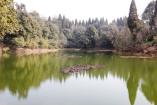
- Rasikbil:
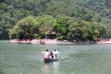
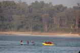
Rashikbill or Rasikbill is a huge lake located in the town of Tufangang in Cooch Behar district of West Bengal. It is a very popular bird watching spot famous for local and migratory birds. It falls on the way to Kamakshyaguri from Alipurduar by train. Rasikbeel is 74 kilometers from Alipurduar by high road. Rashikbill boasts about a jumble of wild flora and fauna. Located around a large lake spreading over 175 hectares area, Rashikbill Lake is surrounded by three dark and dense forests – Nagurhaat, Atasmochar and Bochamari. They are separated by Batikata a small canal. It is a heavenly haven of eco-tourism in the wilderness with breathtaking beauty of its picture-postcard scenery.
- Coochbehar:
Coochbehar was the only princely state of undivided Bengal. By the treaty (1773) Coochbehar became a feudatory state and agreed to pay annually half of the revenue to the British run East India Company.Coochbehar district in the North eastern frontier of India is included in Jalpaiguri Division of West Bengal. Until the 28th day of August 1949, Coochbehar was an Indian state ruled by the Manaraja of Coochbehar who had been a feudatory Prince under the British Government.
- Totopara:
Totopara, a small village is located on the bank of River Torsa of the Jalpaiguri district. This village houses the Toto tribe, a primitive tribe in Dooars. Madarihat, the entry point to the Jaldapara Wildlife Sanctuary is at a distance of 22 km from this village. The village is bordered by Bhutan to the North, Torsa River to the East and Titi River and Titi Reserve on the South-West, separated by Hauri River.
- Dhupjhora:
Dhupjhora south Park is situated alone in the lap of nature and from all the hustle-bustle from the modern life. The resort lying in the flood plains of Muri river and Jaldhaka river overlooking Gorumara National Park. Dhupjhora South Park just on the south bank of Murti river is a wonderful place to spend a few nights amid virgin nature.View of sunrise and sunset from the river bed is really unforgettable.
Dhupjhora South Park is located in south Dhupjhora, a few kms away from Batabari market, around 20 kms away from Lataguri market and 10 kms from Chalsa.As the unique location of the resort, it is always a good chance to watch one horned rhinos, Indian elephants, bison, deer etc roaming in the forest or drinking water from river.
- Chilapata/Raimatang:
Chilapata Forest is a dense forest close to Jaldapara Wildlife Sanctuary in Dooars, West Bengal, India. It is nearly 22 kilometers from Alipurduar and just a few minutes away from Hasimara town.This forest is used by the Elephants as a corridor to migrate from between Jaldapara and the Buxa Tiger Reserve and ultimately to Bhutan. Nature here is rich with wildlife and various types of Flora and Fauna. Angling, Birding, Safari are the few options. The forest used to be home to large Rhinoceros populations.
Raimatang is nearly 45 kilometers from Alipurduar and 220 kilometers from Siliguri. It is beautifully located with scenic beauty and is surrounded by rivers and hills. It is a nice place to enjoy the beauty of nature. Scenic beauty is the main attraction of this place and another pleasant and exciting experience is a trip through the Hasimara Forest.
- Bhutan Ghat:
Bhutanghat is situated nearly 45 kilometers from Alipurduar and 218 kilometers from Siliguri in West Bengal, India. It is approachable from Siliguri, Alipurduar and Cooch Behar by railway and roadways. Known for its scenic beauty it is idle for leisure holiday and angling. Strategically located near the border with Bhutan the region is blessed by the scenic beauty and the swift flowing River Raidak. There is a beautiful forest bungalow built in 1904 close to the River bank and is best to stay is during monsoon or just after the rains. It is located in a mountainous terrain, flanked by hills covered with luxurious green forests.
- Bodaganj/Ambari:
Bodganj and Ambari are small settlement in the region wherever the forest stretch is bit less. Greenery and the surrounding make these places attractive. These are some more places of tourist interest and are closer to Siliguri and situated in the Duars or Dooars belt used by hoards of people as picnic spot or for safari or even for angling and birding. Teesta Canal passes through some of these places. All these places are at a distance of 25 kilometers to 90 kilometers from Siliguri or Jalpaiguri town. Bodaganj is 25 kilometers away from Jalpaiguri and nearly 55 kilometers from Siliguri situated in the Shikarpur forest. Nearest station is Ambari.
- Oodlabari:
Oodlabari is a small town on the National Highway 31 that passes through Dooars. The small town is located about 40 kms from Siliguri. On the west of the town is river Leesh and on its east is river Chel. The stretch between the two rivers, where Oodlabari town exists, is hardly 2 kms wide at its widest. The location of Oodlabari makes it one of the most scenic destinations of Dooars. However the town itself has a very mundane look and may disappoint the uninitiated. One has to look beyond the concrete houses on both sides of the road to get a feel of real Oodlabari.
- Lepchakha/Rovers Point/ Mahakal cave:
Lepchakha village is often considered as the “Queen of Dooars” due to its bewitching panoramic vista of the 12 rivers flowing through Dooars which looks like glistening snakes meandering through the plains along with the serene ambiance which have left many tourists spell bound by the Lepchakha’s beauty. The trekking trail towards Lepchakha is filled with pictorial destination from historical spots like Buxa fort, an important landmark of Buxa tiger reserve, to a forest route full of numerous orange orchards.
Rovers Point, Lataguri Overview. A mere 3 km from the nearby Buxa Fort, the Rover's Point is the most splendid hilltop view in all of Lataguri. The hill top peaks into the densely forested valley and gives you the perfect opportunity to put your camera to a good use.
Mahakal Cave is located in Jayanti village in the premises of Buxa Tiger Reserve in the Jalpaiguri district. Mahakal Cave is a stalactite cave dedicated to Lord Shiva. It is well known among tourist circles as a destination for sightseeing and pilgrimage for Hindus as the cave is devoted to Lord Shiva. The trek to reach the Mahakal Cave runs through the dense forests which has got famous for fantastic bird watching. It has three adjacent caves hosting idols of different gods and goddesses. The first one has the idols of the trinity of Brahma Vishnu and Maheshwara. The second and the middle one host the idol of Lord Shiva while in the third one dwells the Goddess Mahakali.
- Buxa Trek/Lepchakha Trek:
Buxa Fort is located at an altitude of 867 metres (2,844 ft) in the Alipurduar District, West Bengal. It is located 30 kilometres (19 mi) from Alipurduar, the nearest town.The Bhutan King used the fort to protect the portion of famous Silk Route connecting Tibet with India, via Bhutan. Still later during unrest in Occupation of Tibet, hundreds of refugees arrived at the place and used the then abandoned fort as refuge.
Communication/Connectivity
Airways – Bagdogra Airport (IXB) is approximately 100 kilometers from Darjeeling. Bagdogra airport is served by regular Indian Airlines, Spice Jet, Kingfisher and Jet Airways. There are daily flights from Kolkata, Guwahati and Delhi. The airport is well connected by road and railways. Private vehicles for nearby tourist spots are available from the airport.
Railways – Darjeeling has a narrow gauge Junction with the heritage train plying from New Jalpaiguri (NJP) to Darjeeling on daily basis. New Jalpaiguri (NJP) is approximately 100 kilometers away and is the nearest major railway station. New Jalpaiguri (NJP) station has all the three gauges i.e. Narrow, Meter and Broad. There are regular train services to all the major railway station like Chennai, Delhi, Kolkata, Patna, Mumbai, etc.
Roadways –The main mode of transport in the area is roadways and is well connected to the rest of India. National Highway 31 is the main highway passing through Duars. Regular bus services provided by North Bengal State Transport Corporation and Assam State Transport Corporation and other private vehicles are also available, except during tourist season, when it is to be booked prior. Gorumara is 75 kilometers from Siliguri, Chapramari is 68 kilometers from Siliguri, the Buxa Tiger Reserve is 200 kilometers from Siliguri and the Jaldapara is 124 kilometers from Siliguri.
- Get in touch
Get In Touch


India:
Red Planet Tours & Travels
Elite Plaza (opp. Vishal Cinema)
2nd Mile, Sevoke Road
Siligur - 734001
Phone: +91 9933132575(IND)
Nepal: Kathmandu
Red Planet Tours & Travels
Near Hotel Yak & Yeti Road,
Yak & Yeti Lane
Durbar Marg, Kathmandu, Nepal
Phone: +977 1 5330683/+977 9852662216
Nepal: Kakarbhitta/Kakarvitta
Red Planet Tours & Travels
Main Road, Mechinagar Nagarpalika - 06
Post: Kakarvitta, Jhapa, Nepal
Phone: +977 9842633669